タレムザン
| 別名 | マアドナ / ダイエト・エル・マアドナ |
| ラテン表記 | Talemzane / Maadna / Daiet el Maadna |
| 緯経度 | 北緯 33°19′ (+33.32°) / 東経 4°02′ (+4.03°) |
| 国/地域 | アルジェリア |
| 直径 | 1.75 km |
| 年代 | < 3 Ma (Grieve 1987) |
タレムザン・クレーターは、ラグアット(Laghouat)南西120 kmに位置している。直径は1750 m、深さは70 mの円形の窪地である。地元ではダイエト・エル・マアドナ(Daiet el Maadna)と呼ばれている。
基盤岩は新生代の石灰岩である。クレーターの縁は周辺に比べて盛り上がっている。角礫化した石灰岩が、クレーターの底や縁に分布しているが、これらはクレーター周辺にしか存在しない。
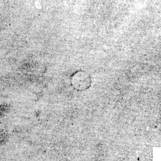
タレムザン・クレーターのランドサット画像。
|
|
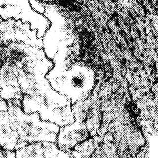
画像準備中 航空写真。
Karpoff)
|
画像準備中 SIR‐A(シャトル・イメージング・レーダー)画像。
Theilen‐Willige, 1987, in "Research in terrestrial impact structures" ed. by J. Pohl, 124, Plate 3)
|
画像準備中 LANDSAT画像。
Theilen‐Willige, 1987, in "Research in terrestrial impact structures" ed. by J. Pohl, 124, Plate 4)
|
画像準備中 タレムザンと他のクレーターの位置。
Lambert et al., 1981);(from Theilen‐Willige, 1987, in "Research in terrestrial impact structures" ed. by J. Pohl, 124, Fig. 6)
|
画像準備中 (From Karepoff)
|
画像準備中 東の外輪山からの写真。
Lambert et al.(1980), Meteoritics, 15, 166, Fig.9)
|
文献
Lambert, P; McHone, JF Jr.; Dietz, RS; Houfani, M. 1980. Impact and impact‐like structures in Algeria. Part I. Four bowl‐shaped depressions. Meteoritics, 15, 157–179.
Theilen‐Willige, B. 1987. “The Use of Airborne and Spaceborne Radar Images”. Research in terrestrial impact structures. Pohl, J., ed. Frider. Vieweg & Son, 115–130.